Staying Safe
I love a good adventure. The emphasis is on good.
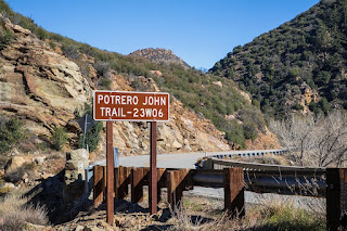
I started in Ventura and drove up California Highway 33 this past Monday. Potrero John Creek Trail was the destination.
Potrero John Creek is in the Sespe Wilderness of Los Padres National Forest.
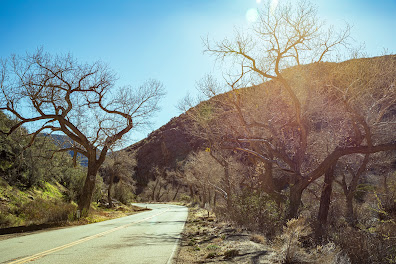
Highway 33/Maricopa Highway is a stunning drive that quickly rises from the Pacific Ocean to over 3000 feet elevation. Soon after leaving Ventura, the road goes through Casitas Springs, which is the home of Johnny Cash.
Cellular phone service dropped out even before I had properly left Ojai, the last town before heading up the mountain.
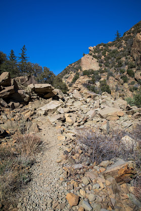
The trail is rocky and remote. I was not prepared for either. I was the only person on the trail. In fact, there was no one around, and car traffic was extremely sparse. I made a game-time call to venture slightly down the trail, but not to go too deep, given that I had no way to reach help should anything go wrong.
Potrero John Creek
This led me to look into purchasing a satellite SOS device that works independent of cellular service. Of course, getting a device isn't the only consideration. I should have brought along a hiking buddy. It was foolish to go to an unknown trail alone.
I did purchase a Garmin InReach Mini2. I decided on the Garmin because it has a screen - albeit, a tiny screen - which can be useful should a bluetooth linked cell phone fails to work. A number of other devices in this category do not have a screen and are 100% dependent on their linkage to a working mobile phone.
The device is expensive. Yet, I prefer to have one instead of wishing I had one should a situation go in the wrong direction for me, or if I happen upon someone else who is in trouble.


Comments
Post a Comment
Thanks for joining the conversation.